135 KM | Grade 1-2 | 2-4 Days
Open year-round, this smooth and wide, well-formed trail requires moderate fitness. Whether you walk it or ride it, this trail is full of variety – from undulating to flat to meandering; there is something new to discover around every corner.
It can be ridden in either direction, in its entirety over 2-4 days, or in shorter sections as day rides. The trail is part of the Ngā Haerenga Great Rides of New Zealand network.
Watch: Clutha Gold Trail Highlights Video

Discover the captivating heritage and scenic wonders of the Clutha Gold Trail on a two to four day, easy (grade 1-2) cycle and walking trail covering 135 kilometres between Roxburgh Dam in Central Otago and Waihola in the Clutha region.
A new 62km extension to the trail between Lawrence and Waihola was opened on 25th August 2023, so now the Clutha Gold Trail connects the existing network of trails in Central Otago and Clutha with a continuous cycle path all the way to the East Coast.
From whichever end you chose to start, this trail offers a real rural heartland experience combined with a wealth of gold mining history, where you'll get the sense of the many adventurous souls who have travelled this path before – Māori, the pioneering run holders, the goldminers and the early Chinese settlers.
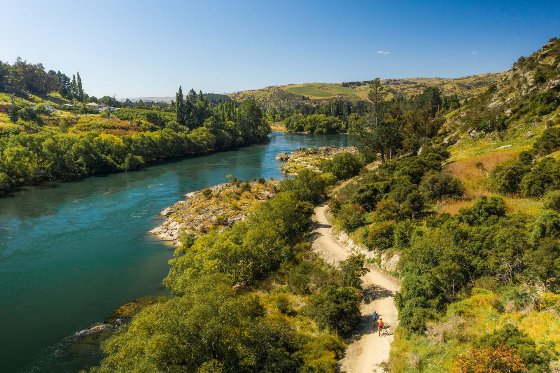
Be immersed in a tapestry of diverse landscapes from Central Otago's iconic rugged semi-arid dry lands through to lush green contoured farmlands and woodland. Over 50km of the trail travels alongside the powerful Clutha | Mata Au River and its distinctive turquoise colour, and finishes on the shores of Lake Waihola a protected wetland environment.
The Clutha Gold Trail will take you on a journey of discovery, offering a unique heritage experience set within diverse and stunning landscapes, and with the trail's proximity to the Otago Central Rail Trail and Roxburgh Gorge Trail you will have the opportunity to experience even more of Central Otago’s unique scenery and hospitality.
Learn more about the trails sections to help plan your ride below, or visit www.cluthagold.co.nz
Need more assistance with your trip planning? Then email the helpful team at the Roxburgh isite visitor information centre.

Clutha Gold Trail Sections
-
Commissioners Flat to Roxburgh Town - 9.4km
This section of the trail takes you alongside the mighty Clutha Mata-au River - its distinctive turquoise colour, constant flow and ever changing moods become interwoven with your experience. Look out for signs of the original search for gold and imagine what the hardy settlers faced in the early days.
As you travel downstream you cannot miss the orchards on both sides of the valleys creating a splash of colour at every season.
Be sure to cross the bridge into Roxburgh township - whether its just to rest and relax, take on refreshments or seek out the towns creative arts and sculptures.
-
Roxburgh to Millers Flat - 19.6km
Meander along the riverside and enjoy a break in your journey at Pinders Pond, 5km beyond Roxburgh. Pinders Pond is a favourite safe swimming spot in the summer for the locals, as although it might look tempting on a hot day - swimming is not recommended in the swift currents of the Clutha Mata-au river.
There are many things to look out for along this part of the trail, including stunning rock formations both on the hillsides and in the river, orchards, and the largest stand of regenerating native Kanuka (tea tree).
-
Millers Flat to Beaumont - 24.7km
This section of the trail takes you from the pastoral farmland and orchards around Millers Flat through the remoteness of Beaumont Gorge where the trail is a mix of quiet roads and trail on the old railway line, before re-emerging beside the main highway at the Beaumont Bridge.
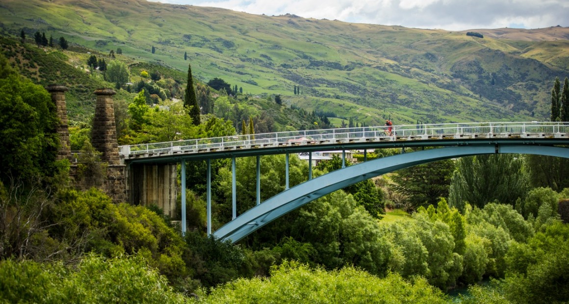
Visit the Historic Horseshoe Bend Bridge, and for an added story take a short detour from the Horseshoe Bend Bridge car park up the road to the site of the Lonely Graves.
-
Beaumont to Lawrence - 19.4km
From Beaumont you start the climb towards the highest point of the trail and through the Big Hill Tunnel (a torch is recommended for the tunnel). After the tunnel you descend into lush green farmland connecting with and crossing the highway several times, before arriving in Lawrence - Otago's first gold rush town.
There are many reminders of the area's history along the route, including discovery of gold, milling flax fibre for rope making around Evans Flat and the arrival of the Chinese prospectors to the goldfields.
-
Lawrence to Waitahuna - 14km
The discovery of gold at Gabriel's Gully by Gabriel Read in May 1861 led to the Otago Goldrush and saw the town of Lawrence boom. A detour from the trail here of 4km (20mins cycle one way) to visit Gabriel’s Gully is highly recommended.
Departing Lawrence, the trail climbs gently before the easy grade 2 trail brings you to the small settlement of Waitahuna, where you’ll find a coffee cart and refreshments (closed in winter - check opening times) at the historic Waitahuna Railway Station and goods shed.
-
Waitahuna to Milton - 31km
The trail between Waitahuna and Milton is gently undulating and partially follows the old railway line through rolling green countrywide and woodlands. There are two tunnels and a viaduct to explore along the way so remember a torch for the tunnels and ring your bell to let people in the dark know you’re approaching! Mount Stuart Reserve, about halfway along this section, is an idyllic spot for a picnic with plenty of shade in the summer.
There are no services between Milton and Waitahuna so remember to fuel up with coffee and snacks in either Milton or Waitahuna before you depart. Cell phone coverage is also limited in places.
Caution: the trail crosses the main road (SH8) several times and there are some short sections where the trail shares public gravel roads, so be aware of traffic and normal road rules apply.
-
Milton to Waihola - 17km
As Milton was close to an easy route to Central Otago, it grew quickly during the goldrush years of the 1860s and became a major staging post for prospectors heading for the goldfields. Likewise, today, Milton is an important service centre for cyclists and walkers on the Clutha Gold Trail heading to or from Lawrence.
From Milton, the trail follows a wide, flat floodplain and includes an impressive section of boardwalks around the wetlands and shore of Lake Waihola. Take your time to enjoy the landscape and nature around Lake Waihola and appreciate the extensive habitat restoration along the trail.
Clutha Gold Trail Map
The Clutha Gold Trail can be cycled or walked from either direction. It can be ridden in its entirety over 2-4 days or in shorter sections as day rides. Download the map and learn about the sections of the trail and how they can be enjoyed.

Support the Clutha Gold Trail

The Clutha Gold Trail is managed by a charitable trust and donations are vital for trail maintenance.
If you would like to support the Clutha Gold Trail, then you can purchase a trail pass which contributes to maintenance, or you can make a donation by clicking the button below.
The Trust is always striving to improve the trail experience, so if you’ve ridden the trail, please provide your thoughts and feedback by completing a trail survey. Thank you.

Clutha Gold Trail Highlights

Clutha Gold Trail
With easy riding, inspiring riverside scenery, flinty history and genuine hospitality, the Clutha Gold Trail is a journey of discovery.
 Play Video

OUR REGIONAL VALUES
Make a Difference
Be at the cutting edge, setting directions and accepting challenges.
Respecting Others
Take the time to listen and understand other people’s opinions and cultural differences.
Embracing Diversity
Be open to new ideas, open to exploring the possibilities and appreciate the strengths and talents each person brings.
Adding Value
Always ask ourselves is there a better way – one that achieves a premium status, quality experience or interaction.
Having Integrity
Seek to be open and honest in all our interactions.
Learning from the past
Choose to learn from past experiences with the future generations in mind.
Making a sustainable difference
Make decisions with the community in mind and in harmony with the natural environment so we can help create the kind of place we can be proud of.
Protecting our rich heritage
Protect and celebrate our rich heritage in landscapes, architecture, flora, fauna and cultural heritage.
Meeting our obligations
Do the right thing by our region and check what legal requirements need to be met before you get started.


